


General contracting
Engineering surveying
1/1
Number of views:
1000
Engineering surveying
Number of views:
1000
Category
Product service
Quantity
-
+
产品描述
 Company profile Company profile |
|
|
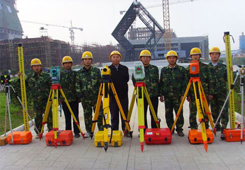
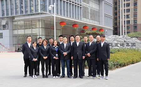 Shaanxi qindi digital surveying and mapping co.,LTD.Is engaged in engineering surveying professional company,registered capital of 3 million yuan,with mapping class B qualification,engineering investigation geotechnical engineering geophysical exploration testing and monitoring class B qualification,engineering survey professional qualification engineering survey class B qualification.The company is committed to the development of surveying and mapping geographic information technology,the introduction of outstanding talents,the purchase of sophisticated equipment,and constantly improve the technical strength.Companies have professional measurement personnel more than 40 people,precision instruments and equipment over 30 sets,such as aerial drones,BIM pay-off robot,global satellite positioning system GPS,total station,such as high precision electronic level advanced instruments and equipment,unmanned aerial vehicle(uav)data processing,digital graphics processing,engineering survey data processing and other professional surveying and mapping geographic information software to ensure production needs.The company follows the tenet of"careful surveying and mapping,honest management,quality-oriented,service-oriented",takes technology as the core,strives for survival by quality,strives for development by reputation,and wholeheartedly provides high quality surveying and mapping technical services for our customers. Shaanxi qindi digital surveying and mapping co.,LTD.Is engaged in engineering surveying professional company,registered capital of 3 million yuan,with mapping class B qualification,engineering investigation geotechnical engineering geophysical exploration testing and monitoring class B qualification,engineering survey professional qualification engineering survey class B qualification.The company is committed to the development of surveying and mapping geographic information technology,the introduction of outstanding talents,the purchase of sophisticated equipment,and constantly improve the technical strength.Companies have professional measurement personnel more than 40 people,precision instruments and equipment over 30 sets,such as aerial drones,BIM pay-off robot,global satellite positioning system GPS,total station,such as high precision electronic level advanced instruments and equipment,unmanned aerial vehicle(uav)data processing,digital graphics processing,engineering survey data processing and other professional surveying and mapping geographic information software to ensure production needs.The company follows the tenet of"careful surveying and mapping,honest management,quality-oriented,service-oriented",takes technology as the core,strives for survival by quality,strives for development by reputation,and wholeheartedly provides high quality surveying and mapping technical services for our customers. |
||
 Business scope Business scope |
||
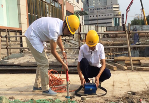
 The scope of engineering survey is: photogrammetry and remote sensing survey, control survey, topographic survey, planning survey, municipal engineering survey, construction engineering survey, line and bridge tunnel survey, deformation deformation and precision survey; The surveying and mapping of real estate includes real estate surveying, cadastral surveying and mapping, and surveying and mapping of administrative boundaries. Can be engaged in engineering control survey, topographic map mapping, engineering survey lofting, foundation pit deformation monitoring, main building settlement observation and other works in building construction engineering, traffic engineering, municipal and road engineering, bridge and tunnel engineering. The scope of engineering survey is: photogrammetry and remote sensing survey, control survey, topographic survey, planning survey, municipal engineering survey, construction engineering survey, line and bridge tunnel survey, deformation deformation and precision survey; The surveying and mapping of real estate includes real estate surveying, cadastral surveying and mapping, and surveying and mapping of administrative boundaries. Can be engaged in engineering control survey, topographic map mapping, engineering survey lofting, foundation pit deformation monitoring, main building settlement observation and other works in building construction engineering, traffic engineering, municipal and road engineering, bridge and tunnel engineering. |
||
 Successful cases Successful cases |
|
|
 |
 |
|
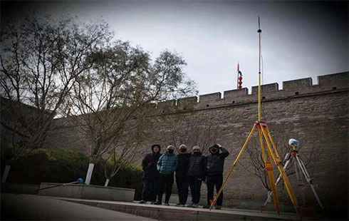
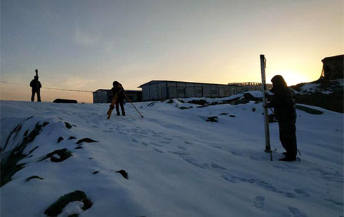
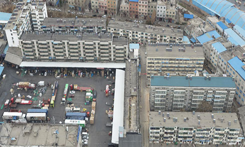
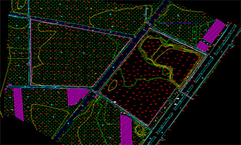
| Project survey of Famen Temple Cultural Scenic Spot | Surveying and monitoring of Xi 'an Metro Line 1 and Line 4 | |
 |
 |
|
| Survey of moat reconstruction section | Deformation monitoring work | |
 |
 |
|
| UAV aerial survey results | Topographic Survey Results | |
Previous
BIM consulting
Related products

Online Message
客户留言
Description:

Address: Kuangshan intersection, East 2nd Ring Road, Xi'an, China (No. 4333, Jinhua North Road)
Zip code: 710032 陕ICP备17011660号 Powered by www.300.cn

Public number
-
Tel
-
E-mail
-
Whatapp
-
Message
-
top
万能表单
默认万能表单
意向信息
意向信息
联系信息
联系信息